 #News
#News
#News
14.04.2026

Technology helps identify malaria transmission zones in Brazil
By analyzing location data from the mobile phones of residents of Manaus, researchers were able to map high-risk areas with greater precision and speed
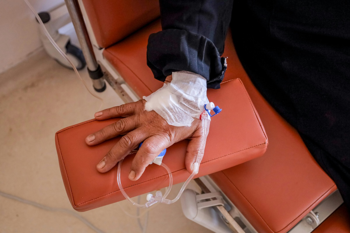
 Research conducted in Manaus, Amazonas, led to the development of a tool capable of identifying malaria transmission zones with greater speed and precision | Image: Tânia Rêgo / Agência Brasil
Every year, thousands of Brazilians still fall ill with malaria, particularly in the country’s Northern region. The challenge lies not only in treating patients, but in preventing disease transmission.
Since the condition is caused by Plasmodium protozoa, which enter the human body through the bite of female Anopheles mosquitoes, identifying the locations of their breeding sites is a key strategy for interrupting the infection cycle. In practice, however, tracking the parasite’s circulation is far from simple.
Traditional surveillance relies on patients’ recollections of where they traveled in the weeks leading up to their diagnosis. In addition, official systems take time to consolidate and release data, which can delay interventions in critical areas.
It was in response to this limitation that a group of researchers decided to rethink the conventional approach to locating breeding sites. Instead of asking infected individuals where they had been, they turned to the digital travel history recorded on patients’ mobile phones.
This approach gave rise to the Sickness Positioning System (SiPoS), a tool capable of pinpointing malaria transmission zones with greater speed and accuracy. Details of the system were published in an article in November 2025 in the journal einstein.
The project brought together scientists from Einstein Hospital Israelita, the State University of Amazonas (UEA), the University of São Paulo (USP), the Manaus Municipal Health Secretariat (SEMSA), the Dr. Heitor Vieira Dourado Tropical Medicine Foundation (FMT-HVD), the Leônidas & Maria Deane Research Institute (ILMD/Fiocruz Amazônia), the Federal University of Amazonas (UFAM), the Amazonas Health Surveillance Foundation (FVS-RCP), and the Institut Pasteur of São Paulo (IPSP).
Digital footprints
The research was conducted in Manaus, where patients diagnosed with malaria were invited to voluntarily and anonymously share the location history stored in their Google accounts.
The data were extracted using Google Takeout, a service that allows users to download their personal information.
More than 800 patients were approached, 104 of whom agreed to participate and provided records of sufficient quality for analysis. To ensure accuracy, the researchers discarded GPS points with an error margin greater than 50 meters.
From that point on, the system’s methodological framework came into play. Each location point was classified according to its timing relative to diagnosis: the symptomatic period, the probable exposure phase—between three and 30 days prior to confirmation—and a more distant interval used as a reference.
This segmentation took into account the average time between the bite of an infected mosquito and the onset of the first symptoms.
Next, an algorithm was applied to identify so-called “stay points”, locations where the patient remained for at least 15 minutes within a 50-meter radius.
The logic behind this selection is that infection requires a minimum period of exposure in an environment where the vector is present, with no risk of bites during brief movements.
Since the malaria-transmitting mosquito is most active at night, the analysis also prioritized records made between 5 p.m. and 6 a.m. These stay points were then analyzed using the DBSCAN algorithm, a density-based clustering technique.
Potential hotspots were defined as clusters with at least three patients within a radius of up to 500 meters.
The system identified 56 clusters of possible transmission in Manaus and its surroundings, with a significant concentration in the southwestern part of the city and in the Tarumã region.
When comparing the results with the Malaria Epidemiological Surveillance Information System (SIVEP), the country’s official database, the researchers found that 97% of the identified points were within one kilometer of areas already classified as likely infection sites.
More responsive surveillance
Unlike traditional methods, the new tool allows spatial analyses to be generated in near real time, as soon as the data are shared.
The authors therefore argue that SiPoS can be a viable, low-cost, and potentially scalable strategy to improve malaria surveillance, especially in vast and hard-to-monitor regions such as the Amazon.
The team also envisions expanding use of the tool to other vector-borne diseases, such as dengue and chikungunya, as well as investigating whether movement history can help distinguish reinfection from recurrence in patients with repeated episodes.
Reference
Silva BM, Giddaluru J, Cardozo LE, Martins FM, Antolini AP, Bargieri DY, et al. Smartphone-based retrospective analysis for malaria hotspot detection. einstein (São Paulo). 2025;23:eAO1826. https://dx.doi.org/10.31744/einstein_journal/2025AO1826
*
This article may be republished online under the CC-BY-NC-ND Creative Commons license.
The text must not be edited and the author(s) and source (Science Arena) must be credited.